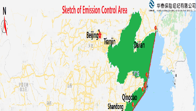
As per information from Yantai MSA, foreign vessels often wrongfully pass through the navigation-restricted areas around Miaodao Archipelago nowadays. As advised, around ten cases happened annually in the recent three years. According to Law of the People’s Republic of China on Maritime Traffic Safety and other relevant regulations, domestic/foreign commercial vessels are not allowed to sail in any channel in the Miaodao Archipelago except for Changshan Channel and Laotieshan channel. The aforementioned navigation-restricted areas have been published on the ECDIS, navigation warnings and Notice to mariners. However, accident of vessels passing through the navigation-restricted areas happens from time to time since sailing vessels, especially foreign vessels, were not familiar with/ aware of the restriction on navigation.
Although it might reduce sailing time and distance for vessels sailing in such navigation-restricted areas around Miaodao Archipelago, there are submerged reefs and fishery farms wherein which may result in vessels’ grounding and/or damaging the fishery farms. This office has handled several fishery farm claims in this area. On the other hand, vessels passing through the navigation-restricted areas will face the local MSA’s maritime investigation onboard and potential administrative penalty in terms of relevant regulation. This may lead to time and economic loss to ship owners.
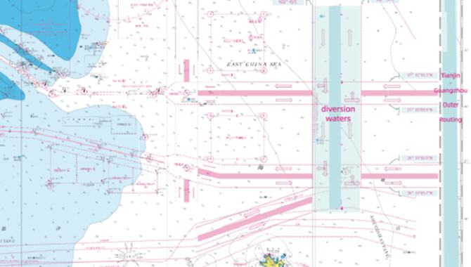
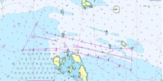
As such, we would like to draw your special attention that only Changshan Channel and Laotieshan channel are navigational areas for vessels entering into or sailing from Bohai Bay. Other sea area is prevented from commercial vessels sailing. Please kindly refer to details of the aforementioned two channels as follows:
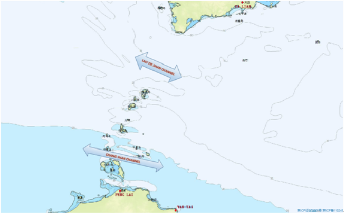 Bohai Straits
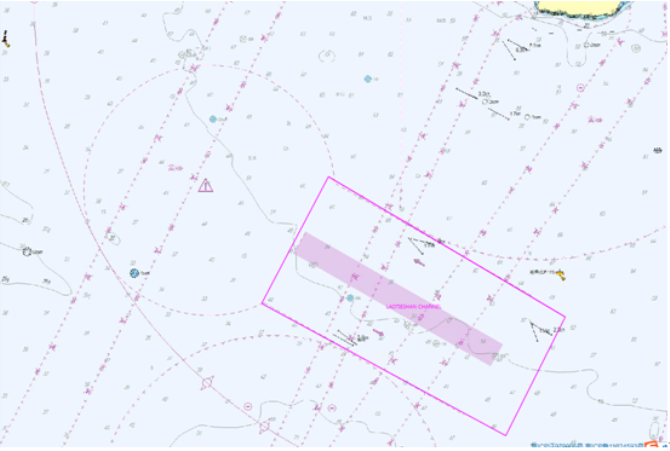
1. LaoTieshan Channel
a. Traffic Separation Zone:
The Separation Zone, which is 9 nm long and 1 nm wide, is centered on the following geographic lines:
38-34.300N 120-55.900E
38-29.800N 121-05.900E
b. The boundaries of the separation zone:
i. The north boundary of the separation zone is the line between the following two geographical points:
38-36.700N 120-57.600E
38-32.200N 121-07.600E
ii. The south boundary of the separation zone is the line between the following geographical points:
38-31.900N 120-54.100E;
38-27.500N 121-04.100E
c. Precautionary Area:
The Precautionary Area is the water within the arc as drew with radius of 5 nautical miles around the center of 38-36.400N 120-51.300E
Bohai Straits
1. LaoTieshan Channel
a. Traffic Separation Zone:
The Separation Zone, which is 9 nm long and 1 nm wide, is centered on the following geographic lines:
38-34.300N 120-55.900E
38-29.800N 121-05.900E
b. The boundaries of the separation zone:
i. The north boundary of the separation zone is the line between the following two geographical points:
38-36.700N 120-57.600E
38-32.200N 121-07.600E
ii. The south boundary of the separation zone is the line between the following geographical points:
38-31.900N 120-54.100E;
38-27.500N 121-04.100E
c. Precautionary Area:
The Precautionary Area is the water within the arc as drew with radius of 5 nautical miles around the center of 38-36.400N 120-51.300E
 LaoTieshan Channel
2. Changshan Channel:
a. Traffic Separation Zone:
The separation zone, which is 23.5 nm long and 0.2 nm wide, is centered on the following geographic line:
38-03.417N 120-29.300E
37-58.450N 120-58.400E
b. The boundaries of the separation zone:
i. The north boundary of the separation zone was the line as connected by following four geographical points:
38-00.700N 120-58.600E
38-00.700N 120-52.200E
38-03.867N 120-34.000E
38-05.600N 120-30.833E
ii. The south boundary of the separation zone was the line as connected by following four geographical points:
37-56.200N 120-58.200E
37-58.267N 120-51.700E
38-00.300N 120-40.000E
38-00.300N 120-27.000E
c. Precautionary Area:
The East Precautionary Area: the water within the arc as drew with radius of 4 nautical miles around the center of 37-58.250N 121-02.500E
The West Precautionary Area: the water within the arc as drew with radius of 4 nautical miles around the center of 38-05.000N 120-24.600E
LaoTieshan Channel
2. Changshan Channel:
a. Traffic Separation Zone:
The separation zone, which is 23.5 nm long and 0.2 nm wide, is centered on the following geographic line:
38-03.417N 120-29.300E
37-58.450N 120-58.400E
b. The boundaries of the separation zone:
i. The north boundary of the separation zone was the line as connected by following four geographical points:
38-00.700N 120-58.600E
38-00.700N 120-52.200E
38-03.867N 120-34.000E
38-05.600N 120-30.833E
ii. The south boundary of the separation zone was the line as connected by following four geographical points:
37-56.200N 120-58.200E
37-58.267N 120-51.700E
38-00.300N 120-40.000E
38-00.300N 120-27.000E
c. Precautionary Area:
The East Precautionary Area: the water within the arc as drew with radius of 4 nautical miles around the center of 37-58.250N 121-02.500E
The West Precautionary Area: the water within the arc as drew with radius of 4 nautical miles around the center of 38-05.000N 120-24.600E
Source:HUATAI
The opinions expressed herein are the author's and not necessarily those of The Xinde Marine News.
Please Contact Us at:
admin@xindemarine.com


.gif)


 Reporting Requirements for Foreign-flagged Ships En
  Shipping Carriers Move to Prevent Deadly Charcoal F
  KR, HD KSOE, HD HHI, KSS Line, and Liberian Registr
 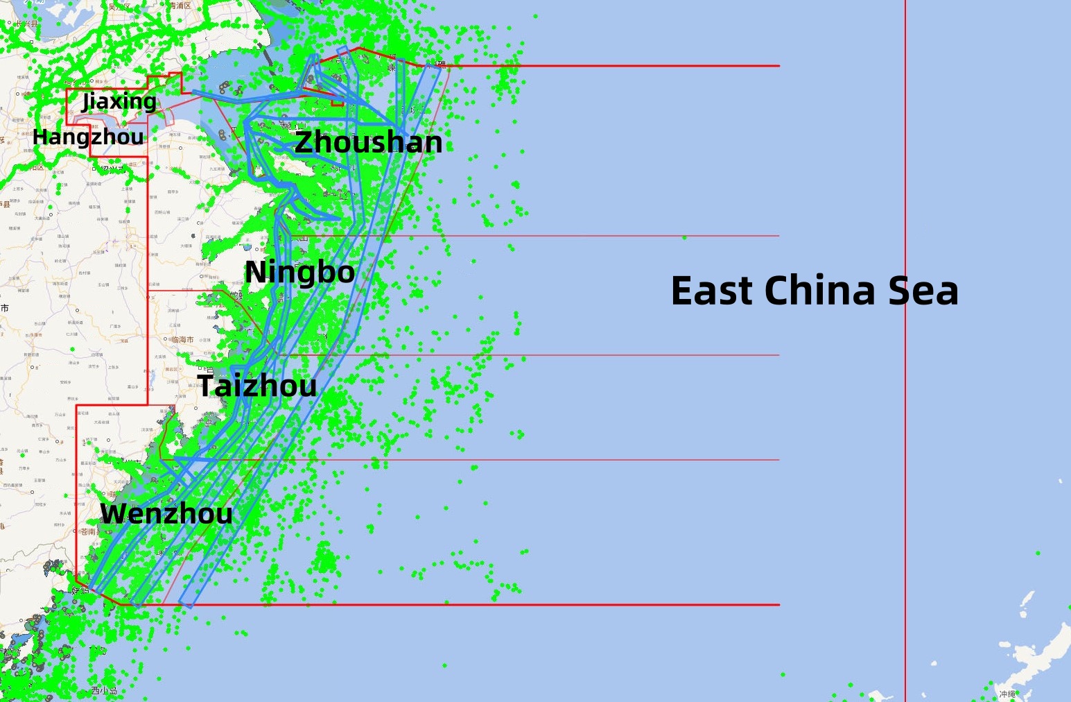 Zhejiang Maritime Safety Administration Issues the “
  RightShip Updates Age Trigger for Vessel Inspection
  KR Publishes Report on Safe Maritime Transport of E